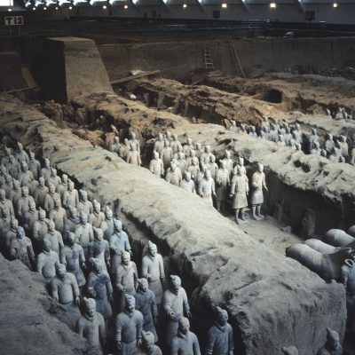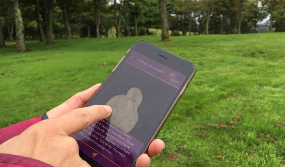
Experience historical world heritage sites in Scotland and soon in Bavaria in 3D on your smartphone and online. People with smartphones in hand are wandering around the Antonine Wall in Scotland. They are not making phone calls or reading chat messages, but instead have opened an app that brings history to life: the “Antonine Wall” app. This is an interactive, location-based app for the northern borders of the Roman Empire. The app contains interactive 3D models and replicas of artifacts that have been excavated at Roman sites. Users can pan, rotate, zoom in or out on the objects and learn about them through text descriptions.
The Centre for Digital Documentation and Visualisation is responsible for the location-based app. It was created as part of a partnership between Historic Environment Scotland and the Glasgow School of Arts to launch digital projects for the preservation of historical heritage. As part of the “Scottish Ten” project, an initiative of the Scottish government, five Scottish and five international UNESCO World Heritage sites, such as Mount Rushmore or the Sydney Opera House, were digitally documented. The creation of 3D data was intended to support the preservation, management, and interpretation of these cultural sites.
The Centre for Digital Documentation and Visualisation is currently working with partners from Germany and Austria on a project called “Advanced Limes Applications” (ALApp). ALApp is funded by “Creative Europe,” the EU’s audiovisual industry support program, to explore the borders of the Roman Empire, which are part of the World Heritage Site “Frontiers of the Roman Empire.” The team is systematically scanning objects found at the Antonine Wall and the Upper Germanic-Rhaetian Limes in Bavaria to create an interactive, location-based app for the northern borders of the Roman Empire.